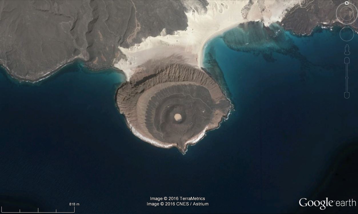
After a long hunt for black lava and cinder cones that took much of the Easter weekend, 547 from Paul (
http://wogepaulvoestermans.blogspot.ca/2016/03/where-on-google-earth-547-in-woge-546.html) was an easier one for me. The red colour was easier to see on Google Earth, and after search Utah and Arches National Park, I moved south to Australia. There I found Kata Tjuta or The Olgas, located just to the west of Uluru.
From Wikipedia (
https://en.wikipedia.org/wiki/Kata_Tjuta): Kata Tjuta, sometimes written Tjuṯa (Kata Joota), and also known as Mount Olga (or colloquially as The Olgas), are a group of large domed rock formations or bornhardts located about 365 km (227 mi) southwest of Alice Springs, in the southern part of the Northern Territory, central Australia. Uluru, 25 km (16 mi) to the east, and Kata Tjuta / Mount Olga form the two major landmarks within the Uluru-Kata Tjuta National Park.
The 36 domes that make up Kata Tjuta / Mount Olga cover an area of 21.68 km2 (8.37 sq mi), are composed of conglomerate, a sedimentary rock consisting of cobbles and boulders of varying rock types including granite and basalt, cemented by a matrix of sandstone.
The highest point, Mount Olga, is 1,066 m (3,497 ft) above sea level, or approximately 546 m (1,791 ft) above the surrounding plain (198 m (650 ft) higher than Uluru).[1] Kata Tjuta is located at the eastern end of the Docker River Road.
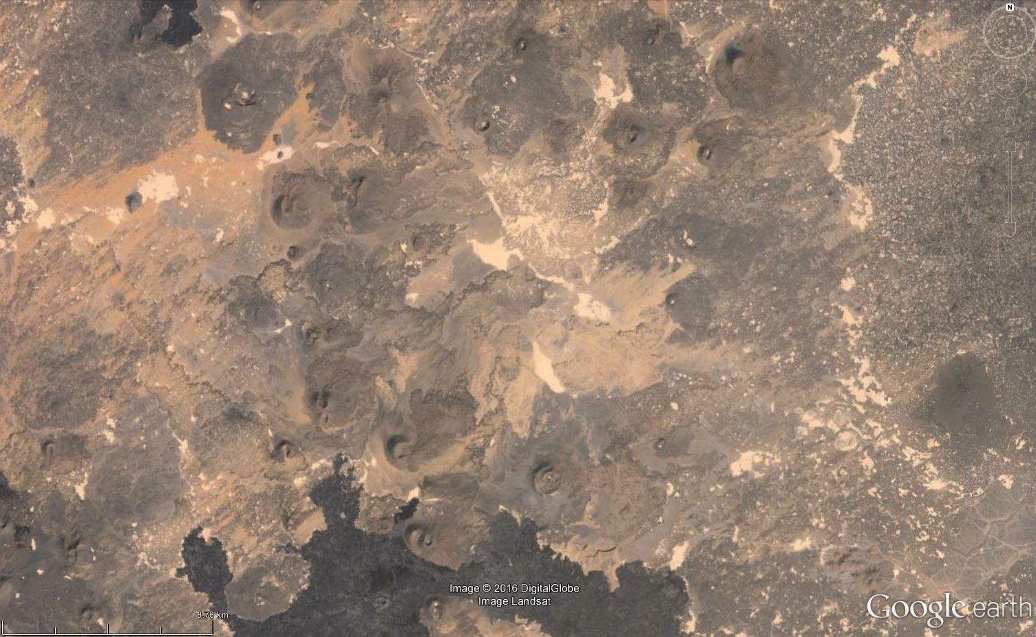
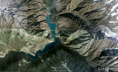
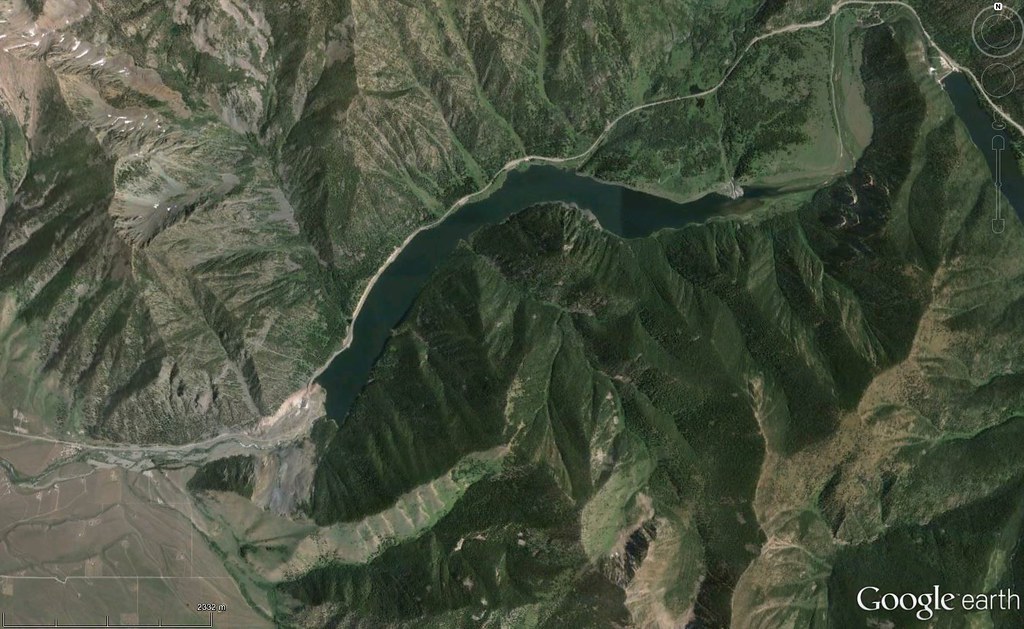
Contest #548 is not red, but shades of blue, green and beige.
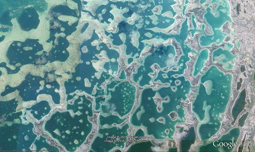
Go here for a bigger version:
https://c2.staticflickr.com/2/1563/26037026881_f48206c0c0_o.jpg
Rules, tips and previous WoGEs are collected by Felix on his http://woge-felix.blogspot.ca/ blog and a KML file is available with all WoGEs.
No Schott rule this time - to give the geologists a chance to wrest the game away from the non-geologists!

