I supplied a link to an explanation of the geology in the area in contest #553. The information is repeated below.
http://www.amusingplanet.com/2013/03/white-pocket-vermilion-cliffs-national.html tells us that the entire area is covered in a gray rocky layer, sometimes only a few centimeters thick, above the red sandstone where the formations heave and drip that makes the entire landscape look like as if it was covered with icing sugar. In some spots the stone layers are completely twisted, just like an enormous marble cake.
The extraordinary geology at White Pocket is not easily explained. Some geologist proclaim that White Pocket is a result of “soft sediment deformation”, meaning the contortions and twisting and turning at White Pocket occurred back in Jurassic time while the sand was saturated and before the sand was completely turned into rock.
According to one retired petroleum geologist Marc Deshowitz, who studied White Pocket more than anyone else, believes the landscape was the result of a huge sand-slide mass, triggered by an earthquake, detaching from a tall dune and traveling rapidly downslope. As the mass slid and tumbled downslope, it ripped up chunks of laminated sand beneath that intermixed with the basal part of the slide. The sand mass eventually filled a large pond or oasis. This large sand mass is the featureless bleached-white sandstone or "cauliflower rock" seen today. The instantaneous loading from the sand mass caused pressure adjustments within the underlying saturated sand resulting in contortions and fluid escape structures such as sand volcanoes. Marc has identified at least 25 of these features supporting his theory.
Contest #554:
Click here for a larger image.
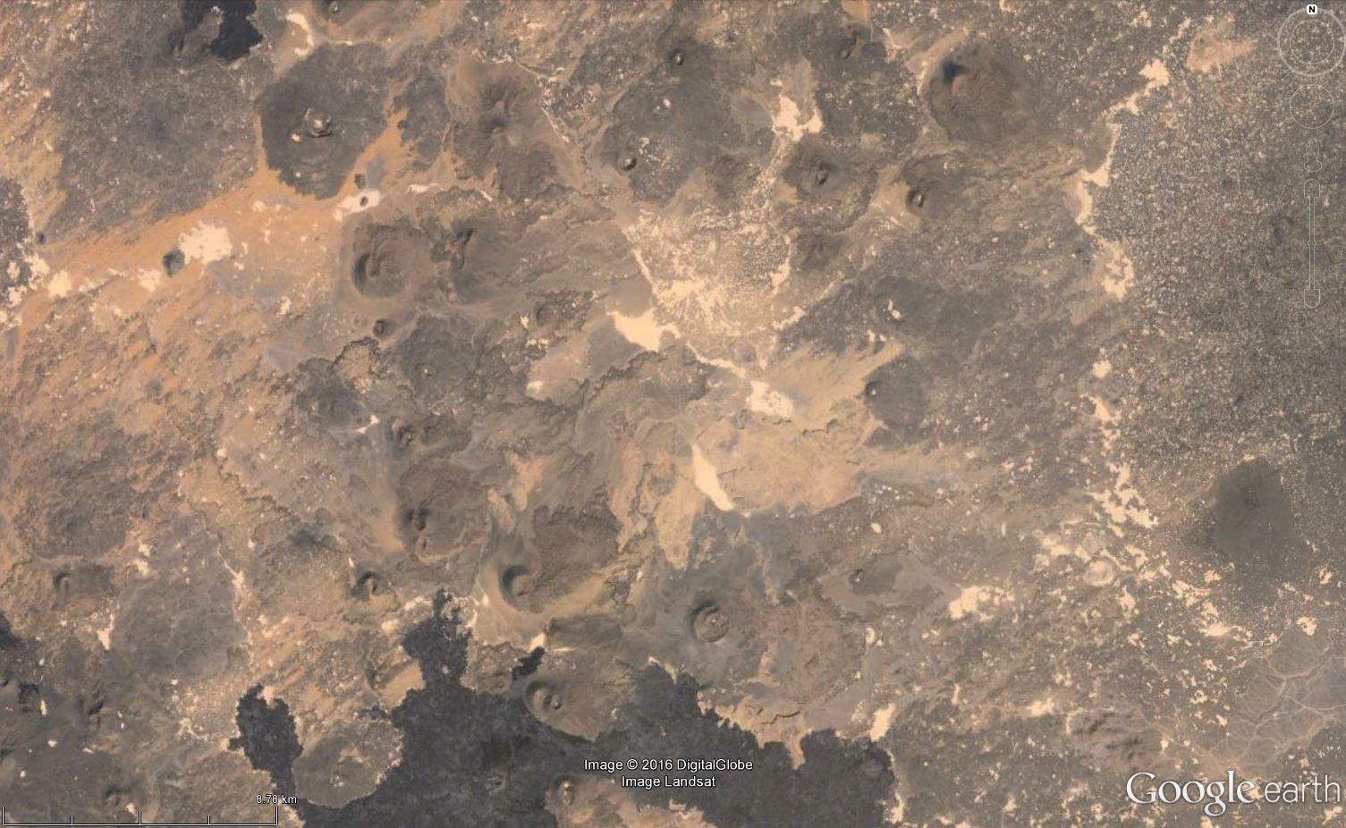
Harrat Ithnayn
ReplyDeleteSaudi Arabia
Volcano types:
Volcanic field Summit Elev: 1625 m
Latitude: 26.58°N
Longitude: 40.20°E
The 4000 sq km Harrat Ithnayn volcanic field contains scattered shield volcanoes and scoria cones. It merges with the much larger Harrat Khaybar volcanic field to the south. The Harrat Ithnayn volcanic field overlies Cambrian sandstones and Precambrian basement rocks. Vents of Harrat Ithnayn form a general N-S pattern, but are more scattered than those of Harrat Khaybar. Harrat Ithnayn rocks are of basaltic and basanitic composition and lack the silicic components present in neighboring Harrat Khaybar. The youngest lava flows from Harrat Ithnayn are less than 4500 years old. An uncertain report of an historical eruption in 1800 AD is considered unlikely by Camp et al. (1991), who mapped no eruptive products younger than about 1500 years from Harrat Ithnayn.
Direct from the "Smithsonian Institution Global Volcanism Program" in Google Earth.
Correct, Ole.
ReplyDeleteBeing a non-geologist, I was unaware that Saudi Arabia has volcanic activity until contest 546 had me searching the globe for cinder conesz
I learned about Saudi Arabian volcanism when I read about the eruption in Medina which threatened the holy city in 1256 CE.
ReplyDeleteThis puzzle was fairly easy - it was a recent volcanic field in a desert area with prevailing west-northwesterly winds. I checked the few Saharan volcanic fields just to eliminate them, then moved to the Arabic peninsula and found easily by checking wind direction and lava field colours.
New puzzle will be up Monday, if not before.
http://overburdenblog.blogspot.no/2016/04/where-on-google-earth-555.html is up - good hunting!
ReplyDelete