In the end, the hint led me to an island in my own country: Cape Breton Island. http://www.pc.gc.ca/eng/pn-np/ns/cbreton/natcul/natcul1/a/iii.aspx has the following information on this interesting geological feature.
The most spectacular fault in Cape Breton National Park is the Aspy Fault which extends 40 kilometres from the centre of the highlands to the ocean. Before the Atlantic Ocean formed, it may even have connected to faults in Europe like Scotland's Great Glen Fault, home to Loch Ness.
Streams in the park cut down into the plateau, forming deep V-shaped canyons. Running water naturally follows depressions in the land, so several rivers in the park follow fault lines. The eroding action of the water as well as the presence of the fault combine to form very deep canyons. The Aspy River flows down the Aspy Fault line in a very dramatic canyon which can be seen from the Cabot Trail.
Contest #563 - hint: it's an island.
Rules, tips and previous WoGEs are collected by Felix on his http://woge-felix.blogspot.ca/ blog with a KML file available with all WoGEs.
The Schott rule applies for this contest (1 hour for every previous win) - published at 19.35 UTC, May 3rd, 2016
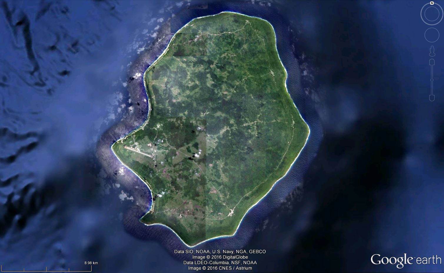
Niue (older name is Savage Island)
ReplyDelete19° 4′ S, 169° 52′ W
Niue is a raised coral atoll in the southern Pacific Ocean, east of Tonga.
The island was lifted from the sea during two earthquakes in two steps. Other elevations of the island cannot be excluded.
Niue is one of the world's largest coral islands. The terrain consists of steep limestone cliffs along the coast with a central plateau rising to about 60 metres above sea level. A coral reef surrounds the island, with the only major break in the reef being in the central western coast, close to the capital, Alofi. A notable feature is the number of limestone caves found close to the coast.
Some of the soils are geochemically very unusual. They are extremely highly weathered tropical soils, with high levels of iron and aluminium oxides and mercury, and they contain high levels of natural radioactivity. There is almost no uranium, but the radionucleides Th-230 and Pa-231 head the decay chains. This is the same distribution of elements as found naturally on very deep seabeds, but the geochemical evidence suggests that the origin of these elements is extreme weathering of coral and brief sea submergence 120,000 years ago. Endothermal upwelling, by which mild volcanic heat draws deep seawater up through the porous coral, may also contribute.
No adverse health effects from the radioactivity or the other trace elements have been demonstrated, and calculations show that the level of radioactivity is probably much too low to be detected in the population. These unusual soils are very rich in phosphate, but it is not accessible to plants, being in the very insoluble form of iron phosphate, or crandallite. It is thought that similar radioactive soils may exist on Lifou and Mare near New Caledonia, and Rennell in the Solomon Islands, but no other locations are known.
Elisabeth.. good job, again!
ReplyDeleteThanks!
ReplyDeleteNew game is here:
http://woge-elisa.blogspot.de/2016/05/where-on-google-earth-564.html
Good luck to all players!
Andrew: if you win a WoGE, please be so kind and post lat/long for the location, so I can find it for my kmz file. Otherwise I have to search for it again. (560, 562) Thank you.
ReplyDelete