Sunday 29 May 2016

Where On Google Earth #572

Little did I know that I would be opening up a can of worms with the fact that I was able to find the location for Ole's 571 but was not really able to identify the geology that Ole was looking for with his additional comment "...what I am after happend when it IS bad."

This link from the Milford Lodge has enough geology for me as a non-geologist. This other site from http://www.fergusmurraysculpture.com has more.

Contest #572:


As always, the first person to post the position and whatever is interesting about the geology/hydrology/geowhatever in this location, wins the privilege of hosting the next WoGE.

Previous WoGEs are collected by Felix on his blog and a KML file.

No Schott rule for this contest.

Saturday 14 May 2016

Where On Google Earth #568

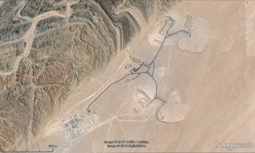
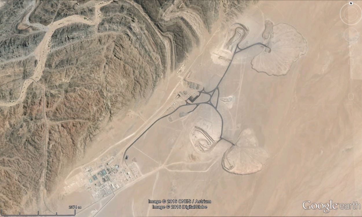
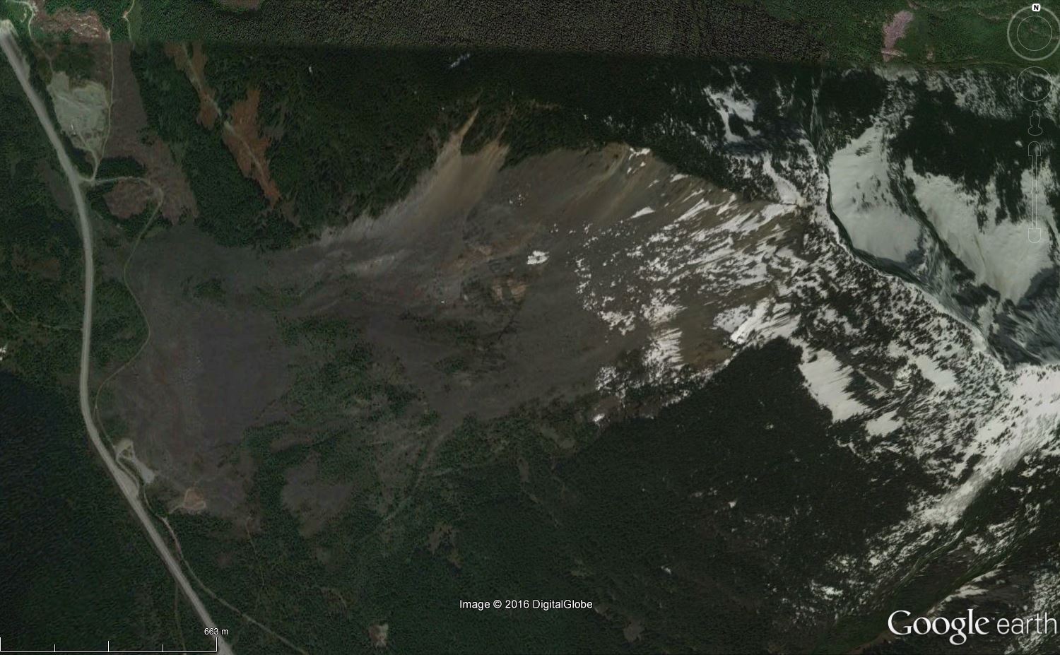
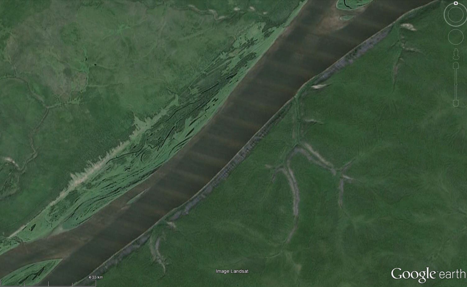
Something about Felix's image for contest 567 struck me as familiar, probably after searching long and hard through deserts across the southwestern US for previous contests, and it was not long before I came across Blackhawk Landslide, off the northside of the San Bernardino Mountains, just east of LA. Location: 34.41N 116.79W.

From a thesis on the geology and mechanics of the slide at http://thesis.library.caltech.edu/691/" is this explanation.

Blackhawk Mountain, a resistant mass of marble thrust northward over uncemented sandstone and weathered gneiss, rises above southeastern Lucerne Valley at the eastern end of the rugged 4000-foot escarpment that separates the San Bernardino Mountains on the south from the Mojave Desert on the north. Spread out on the alluvial apron at the foot of the mountain is the Blackhawk rockslide, a lobe of nearly monolithologic marble breccia 30 to 100 feet thick, 2 miles wide, and nearly 5 miles long. At least two earlier similar but smaller rockslides have occurred in the area.

The rocks of the area comprise late Tertiary and Quaternary fanglomerates and breccias derived mainly from the gneiss, quartzite, Carboniferous marble, and Cretaceous quartz-monzonite of the San Bernardino Mountains. Uplift of Blackhawk Mountain occurred in two stages after deposition of the older fanglomerates and breccias: the first by over-thrusting from the south, and the second by monoclinal folding along a northwest-trending axis.

Geological evidence in the area shows that the Blackhawk rockslide traversed the gently inclined alluvial slope as a nearly nondeforming sheet of breccia moving more than 50 miles per hour. The hypothesis that compressed air, rather than water or mud, constituted the lubricating layer on which the breccia sheet slid qualitatively explains all of the principal physical features of the slide lobe. Theoretical analysis of the flow in the lubricating air layer indicates the quantitative feasibility of the air-lubrication hypothesis for the Blackhawk slide.

Contest #568:


Rules, tips and previous WoGEs are collected by Felix on his http://woge-felix.blogspot.ca/ blog with a KML file available with all WoGEs.

Tuesday 3 May 2016

Where on Google Earth #563

Elisabeth gave us a really tough contest with her 562 - I searched long and hard over northern latitudes looking for fault lines and straight valleys.

In the end, the hint led me to an island in my own country: Cape Breton Island. http://www.pc.gc.ca/eng/pn-np/ns/cbreton/natcul/natcul1/a/iii.aspx has the following information on this interesting geological feature.

The most spectacular fault in Cape Breton National Park is the Aspy Fault which extends 40 kilometres from the centre of the highlands to the ocean. Before the Atlantic Ocean formed, it may even have connected to faults in Europe like Scotland's Great Glen Fault, home to Loch Ness.

Streams in the park cut down into the plateau, forming deep V-shaped canyons. Running water naturally follows depressions in the land, so several rivers in the park follow fault lines. The eroding action of the water as well as the presence of the fault combine to form very deep canyons. The Aspy River flows down the Aspy Fault line in a very dramatic canyon which can be seen from the Cabot Trail.


Contest #563 - hint: it's an island.


Rules, tips and previous WoGEs are collected by Felix on his http://woge-felix.blogspot.ca/ blog with a KML file available with all WoGEs.

The Schott rule applies for this contest (1 hour for every previous win) - published at 19.35 UTC, May 3rd, 2016

Monday 25 April 2016

Where on Google Earth #561

Elisabeth was kind to us with contest 558, but after several previous contests looking for volcanic activity of many kinds, my eye went straight to Iceland, where I was able to track the exact location down.

Once again, the hard part was identifying the geological feature... the Dieldartunguvhev hot spring in the centre of the image - for more information about this spot, go to this link: Deildartunguhver thermal spring

Contest #561:


Rules, tips and previous WoGEs are collected by Felix on his http://woge-felix.blogspot.ca/ blog with a KML file available with all WoGEs.

I will invoke the Schott rule again: one hour delay for each previous win.

Published at 1625 UTC, April 25, 2016

Sunday 24 April 2016

Where on Google Earth #559

Elisabeth gave us a real challenge with contest 558, based on the number of days it remained unsolved by players in the game - as well as how much of the world I had to search trying to find the correct combination of water and rock colours. I was not able to figure out the geological feature and had to resort to scanning GE for hours.

In the end, it was the northern part of Antelope Island, located in the south east corner of Great Salt Lake, Utah. The website for the state park located on the island mentions this for the geology:

Geology is the foundation for Antelope Island, and reveals a long history of complex geologic processes. Rocks on the island range from the oldest to the youngest in the state of Utah. Five periods of geologic time are preserved in detail. Unconformities are due to the area being elevated above sea level wherein rocks were either never deposited or were eroded away. Little is known of the geologic events represented by the older unconformities. The geology controls the collection and distribution of ground water and the location and size of springs.

Contest #559:


Rules, tips and previous WoGEs are collected by Felix on his http://woge-felix.blogspot.ca/ blog with a KML file available with all WoGEs.

The Schott rule applies for this contest (1 hour for every previous win)

Posted at 0015 UTC April 24, 2016.

Friday 15 April 2016

Where on Google Earth #556

The last contest from Ole (http://overburdenblog.blogspot.ca/2016/04/where-on-google-earth-555.html) was very hard for me as a non-geologist. I was able to pick out the "small" sinkholes, but Google searching took me to Guatemala, Japan and many other parts of the world that did not help. The flatness of the image did not help! Ole's hint helped a bit as it directed me towards something that had a special entrance, which turned out to be an underground river.

Luck intervened and I happened upon the Yucatan as a area of the world where there were underground rivers, and the sinkholes were "doors" into them.

Here is contest #556:


Click here for a bigger image.

Thursday 7 April 2016

Where On Google Earth #554

Paul presented us with a challenge that after the past few locations said Arizona, Utah or Nevada in the southwest USA. A quick search of northern Arizona lead me to Vermillion Cliffs National Monument, and to be more specific, the White Pocket area.

I supplied a link to an explanation of the geology in the area in contest #553. The information is repeated below.

http://www.amusingplanet.com/2013/03/white-pocket-vermilion-cliffs-national.html tells us that the entire area is covered in a gray rocky layer, sometimes only a few centimeters thick, above the red sandstone where the formations heave and drip that makes the entire landscape look like as if it was covered with icing sugar. In some spots the stone layers are completely twisted, just like an enormous marble cake.

The extraordinary geology at White Pocket is not easily explained. Some geologist proclaim that White Pocket is a result of “soft sediment deformation”, meaning the contortions and twisting and turning at White Pocket occurred back in Jurassic time while the sand was saturated and before the sand was completely turned into rock.

According to one retired petroleum geologist Marc Deshowitz, who studied White Pocket more than anyone else, believes the landscape was the result of a huge sand-slide mass, triggered by an earthquake, detaching from a tall dune and traveling rapidly downslope. As the mass slid and tumbled downslope, it ripped up chunks of laminated sand beneath that intermixed with the basal part of the slide. The sand mass eventually filled a large pond or oasis. This large sand mass is the featureless bleached-white sandstone or "cauliflower rock" seen today. The instantaneous loading from the sand mass caused pressure adjustments within the underlying saturated sand resulting in contortions and fluid escape structures such as sand volcanoes. Marc has identified at least 25 of these features supporting his theory.

Contest #554:


Click here for a larger image.